Google map Link of course
https://www.google.com/maps/d/u/0/edit?mid=1OiM3Qlw2TkyfYv8g2WvQQHsbRZ5w-ME&usp=sharing
Location: Northfield Mountain Recreation Center, 99 Millers Falls Rd., Northfield, MA 01360
Here is the Site Map for the whole race:
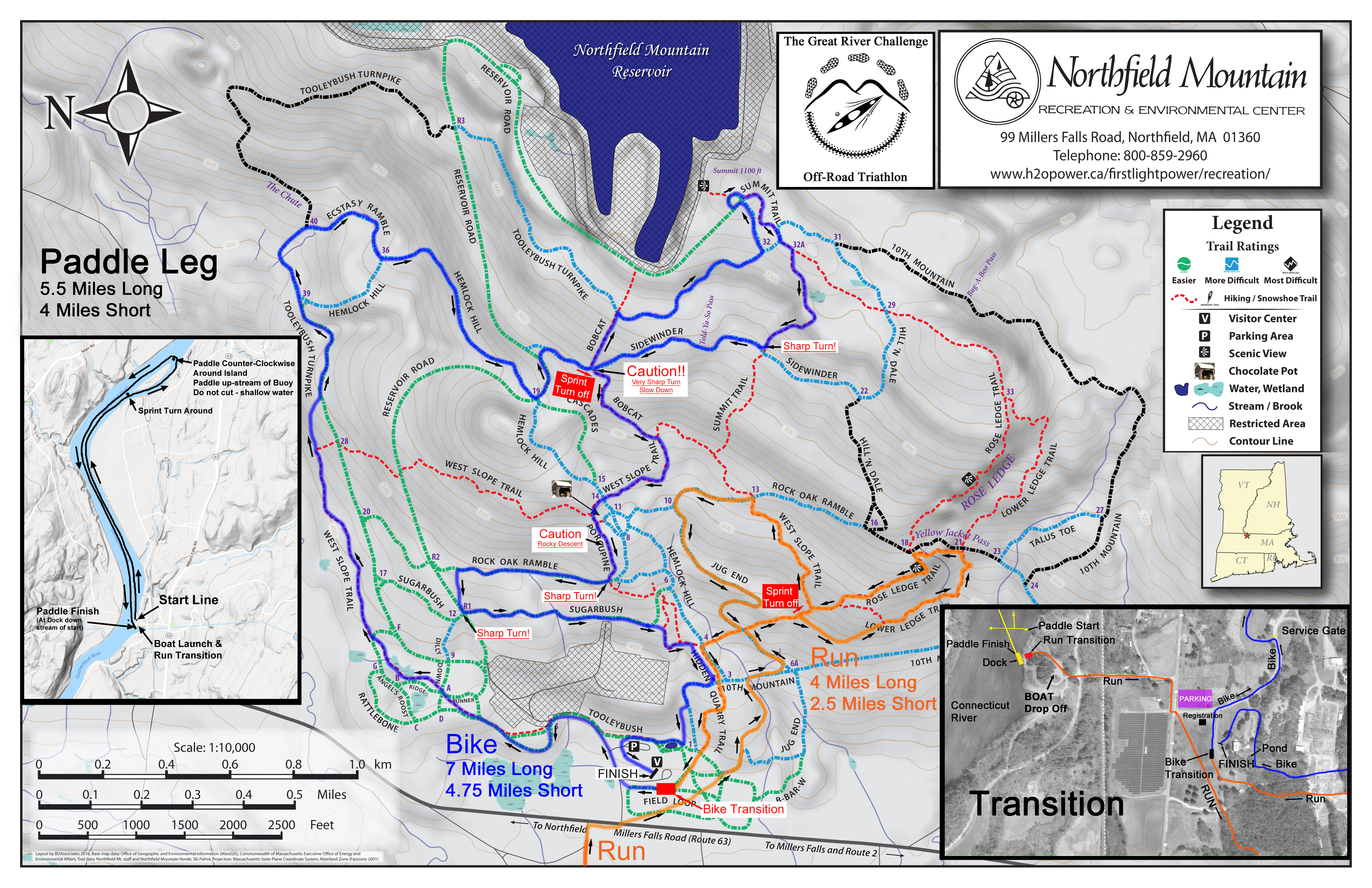
Northfield Mountain Recreation Area & Reservoir trail map 2014 version.
Transition map

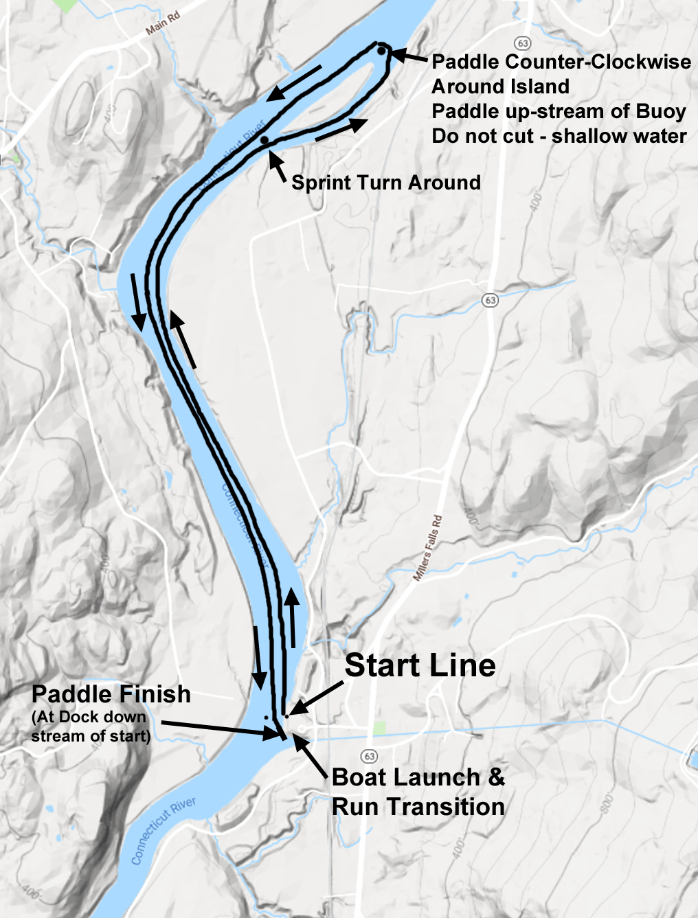
The Map Below is of the paddle course.
Short course turns around before the island around a parked motor boat.
Map below denotes the running and biking course in the woods. see map for short course cut-offs
Orange trail is the run, blue is the bike.
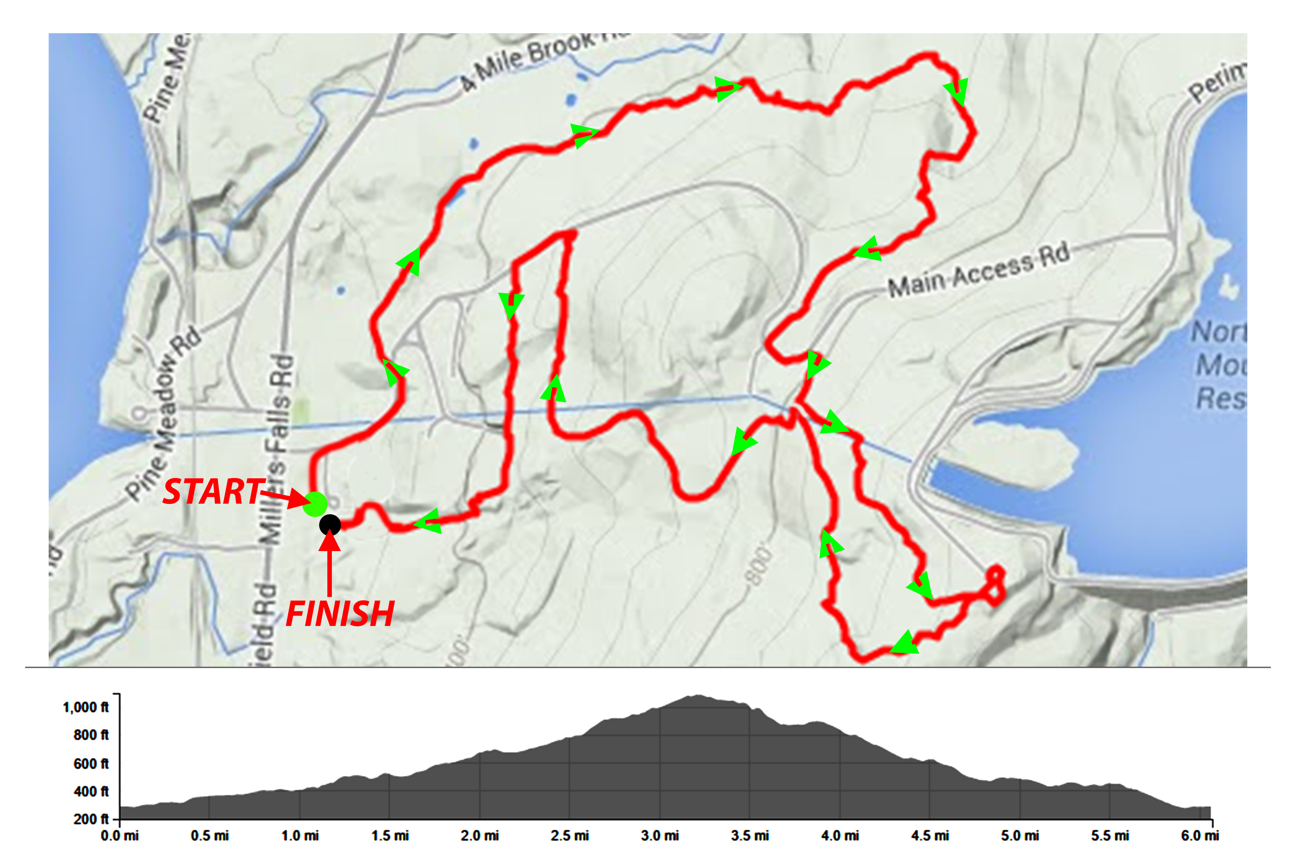
The Map below is a GPS route of the Run trail with the elevation profile.

Run Map
The Map below is a GPS route of the Bike trail with the elevation profile.
The map below is the trail map at the Northfield Mountain Center – red dotted trails on their maps denote single track trails (snow shoe) and the green, blue and black denote wider ski trails.

Northfield Mountain Recreation Area & Reservoir trail map 2014 version.
Printable 8 x 11

Northfield Mountain Recreation Area & Reservoir trail map 2014 version.